An environmentally friendly accommodation is a win-win. For guests – that means a lower carbon footprint holiday. For hotel-owners, it is an opportunity to improve their brand and actually do some good.
Nowadays, you don’t have to settle for just luxury or sustainability. The best hotels in the world offer both. Find a list of incredible eco-friendly luxury hotels for your next vacation.

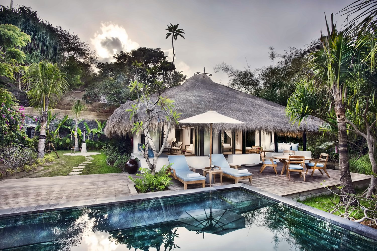
Song Saa Private Island, Cambodia
When visiting the vibrant Cambodia, you might not expect five-star-plus luxury, but at the Song Saa Private Island, you will certainly feel like a true king. Guests of the impressive hotel can make their choice between 9 outer water, 18 garden and beach villas.
As you may guess from the title, the resort is nestled on a private island. Its name “Song Saa” translates to “the sweethearts” in Khmer, and you will definitely feel loved every moment of your vacation. The hotel offers an all-inclusive service, so you don’t have to worry about anything.
With the current situation in the world, all-inclusive resorts are an even more attractive option than usual. Since you don’t have to leave your hotel’s safe “bubble”, you have less risk of being exposed to COVID-19.
Although Song Saa Private Island is an excellent example of lavish luxury, the hotel is all about sustainability. The eco-friendly hotel’s visionary owners, Rory and Melita Hunter, have contributed to the local communities in many ways.
With their help, the first marine reserve has been created in the area, as well as a solid waste management center and many other wonderful projects. For travelers who pay attention to sustainability, the Song Saa Private Island will be an excellent destination.
Nihi Sumba, Indonesia
Dreaming of an island getaway? Nihi Sumba, a hotel that has been awarded first place in the best hotel tops for several years in a row, is proof that luxury can coexist with sustainability. Set on the island of Sumba, the accommodation will be a real treat for the eyes.
Guests of the beautiful hotel may use their holiday as an opportunity to reconnect with a life lived simply and enjoy the incredible natural beauty. Since the hotel is set not far from Indonesia’s best surf spot, those who love a little workout can spend a day catching the waves.
Whether you are looking for a laid-back holiday or a fun-filled adventure, Nihi Sumba will be a pleasant discovery. When it comes to eco-friendliness, it won’t disappoint. The hotel features 33 hand-built suites and villas, all of which have been created using sustainable materials.
What sets the stunning accommodation apart from other hotels is that it is powered by biofuel produced from coconuts. Furthermore, the hotel has its own bio-diesel factory, where all of the magic happens.
The goal of Nihi Sumba is to be a carbon-neutral hotel. So if you decide to book a vacation at the gorgeous accommodation, you don’t have to worry about the impact you will have on the environment.
Furthermore, with its Sumba Foundation, the resort is participating in many different community-based projects.

Borgo Pignano, Italy
There is nothing like a Tuscan holiday! The smell of olive trees, freshly made pasta, and locally-grown tomatoes – it is hard to beat Italy and all it has to offer.
Borgo Pignano is a stylish country estate set in the beautiful Tuscan. Everything about the fabulous hotel has been designed to preserve its surrounding environment. While being eco-conscious, the accommodation still offers a luxurious Italian experience.
The history of the main villa goes back quite far – to the 18th century. Although it has been renovated and modernized, it still holds its unique character.
Borgo Pignano includes 14 carefully designed guest rooms created with locally sourced and environmentally-friendly materials. Those who are lucky get to enjoy rooms with original Italian frescoes.
On-site, you will find an organic farm that has great importance for the hotel’s sustainability goals. Furthermore, the accommodation is actively experimenting with new ways of retaining water.
Honey, grains, cereal, and olive oil are all grown on the local farm, using both innovative and traditional methods.
Who said you couldn’t travel in style but still be eco-conscious? Borgo Pignano is an excellent example you can.
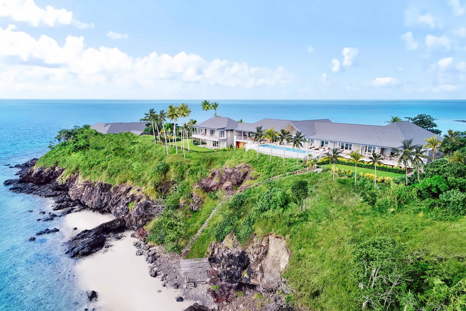
Kokomo Private Island, Fiji
Palm-lined beaches, sparkling water, picturesque coral reefs, and exotic waterfalls – Fiji is a destination right from the books. While vacationing in the tropical paradise, you don’t have to settle just for sustainability or luxury. You can have both!
Fiji’s Kokomo Private Island is the perfect idyllic holiday destination, which not only caters to its guests but also its community. Those who wish to experience the incredible resort may choose between 21 villas and five residences.
In addition, there is an array of activities available that offer to leave a meaningful mark on the surrounding area. For example, guests are welcome to “adopt” one of the endangered manta rays, plant corals in the nearby reef, or grow mangrove seeds.
Since it is an island resort, most of its focus is on preserving the ocean. Kokomo Private Island has its own team of marine biologists, which work protecting marine life and its environment.
Guests of the hotel are treated with only locally grown food because the accommodation includes a 5.5-acre farm.
These are just a few examples of the resort’s good deeds. The eco-friendly hotel participates in many other initiatives, including the Coral Restoration Project, Dock-to-Dish fishing, and others.
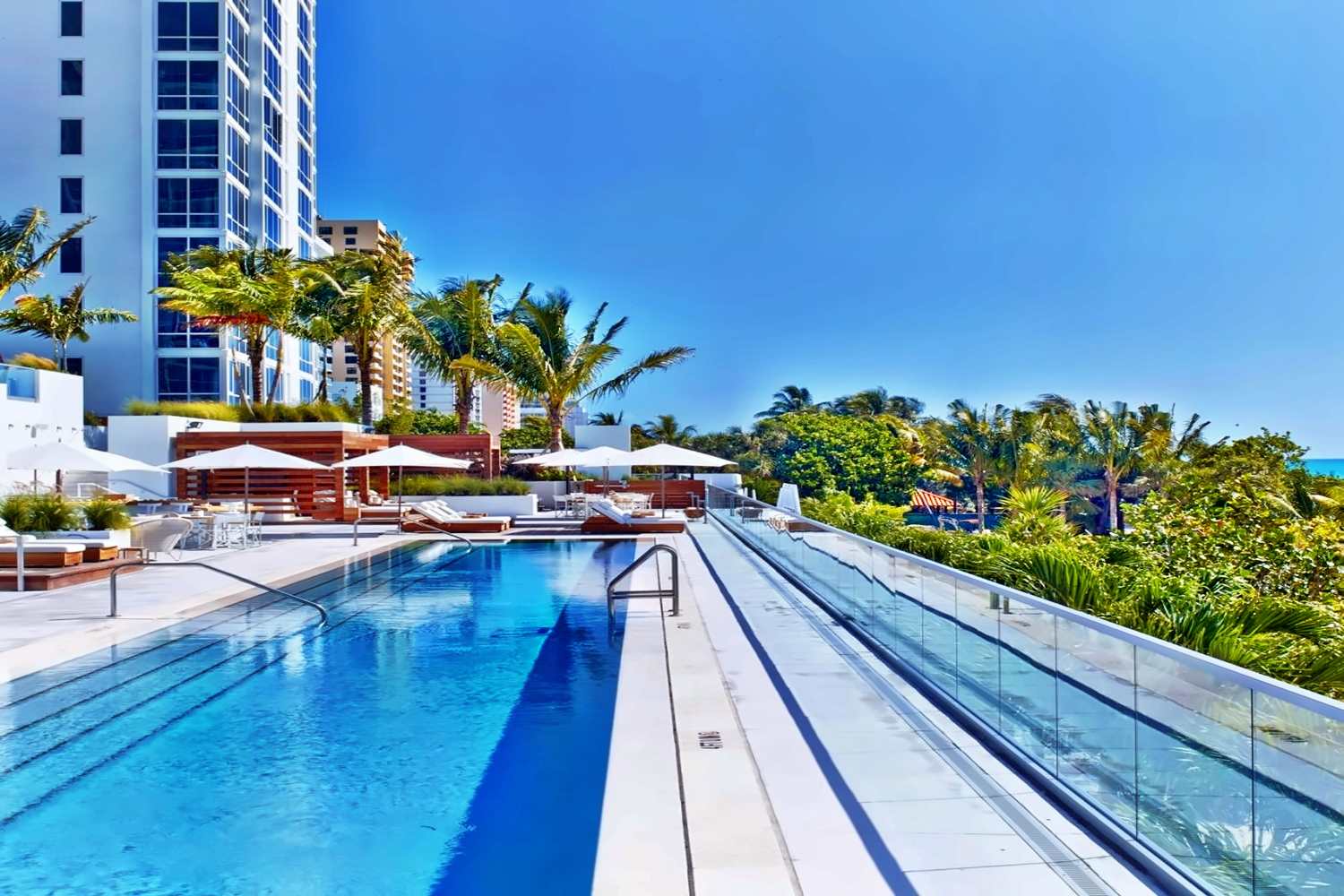
1 Hotel South Beach, USA
For years, Miami has been a top-rated travel destination, thanks to its spectacular dining options, many entertainment opportunities, and beautiful beaches.
Those with a taste for the finer things in life will surely agree that the city is the place to be. Thankfully, the coastal metropolis has its fair share of eco-friendly hotels that offer both luxury and sustainability.
So book your stay at 1 Hotel South Beach, and don’t feel guilty about having the time of your life!
Nature has been the inspiration behind all the rooms at the incredible hotel, and you can see it as soon as you take your first steps into it.
Enjoy the luxe eco amenities at their best – in-room water filtration systems to avoid the use of plastic bottles, bamboo speakers, and closet hangers from recycled newspapers (yes, really!).
Of course, 1 Hotel South Beach still offers everything the luxury hotel chain is known for, including attentive service. The accommodation features one of the best rooftop pools in Miami, which overlooks the South Beach.
Change starts with small things. Respecting and protecting the environment is more important than ever. While staying at one of these amazing hotels, you can contribute to a good cause while still having a great time.
Book your stay through PrivateUpgrades and have a fantastic holiday!